
Manifesta13
dreaming of...
Mezze Pizza
Forest Rangers
Story Telling in the Anthropocene
-
Sympoiesis at Tenderbooks
- Pig-Pen’n’Friends
- The Terminal Lagoon
- Becoming Plant
- Bright Spot
- If Dolphins had Thumbs
- We are all wolves
- IROPI
-
Writing World/ Writing Time
Broadcast
- Aesthetic Of Dishonesty
- Favour Bank
-
380:1
- Body Is Circuit
- Acoustic Mirrors
- The Oysters’s Your World
- I Hear Thrumming
- 5 Amazing Tricks To Get Rid Of
- Diaspore’s Diaspora
Podcasts
Ronces
BRIGHT SPOT
Nastassja Simensky
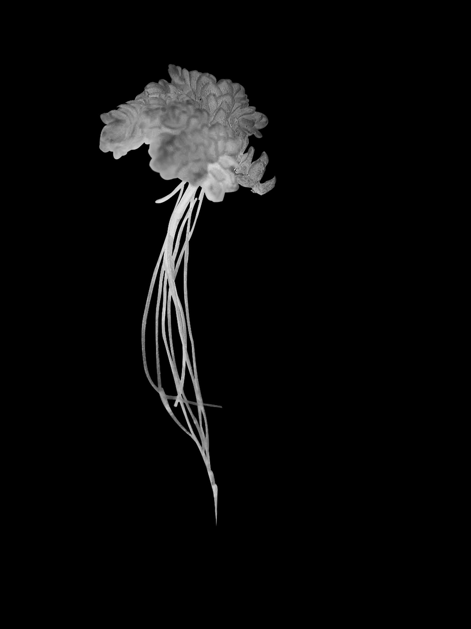
Floating freely on slow-moving, freshwater bodies such as lakes, pools and gently flowing rivers, Azolla Filiculoide is one of the Earth’s fastest growing ferns, doubling in biomass in as little as two days. Slight, diamond-shaped leaves, two millimetres across, cluster the water surfaces, by putting out numerous thin roots below individual plants, connecting up to form vast mats.
During an Azolla bloom in the early Eocene some 56-34 million years ago, blankets of tiny Azolla absorbed the carbon dioxide needed for growth directly from the atmosphere, reducing greenhouse gases and ending a hot climate that had prevailed for hundreds of millions of years. Levels of atmospheric carbon dioxide were reduced by up to a half by organic carbon burial, as the Azolla mats that once populated a warm and balmy Arctic region repeatedly died back and sank to the bottom of the ocean. The atmospheric carbon dioxide sequestered by Azolla was incorporated into the plant biomass, preserved in sediments beneath the Arctic. Under high pressure the petrified plant matter, plankton and carbon were transmuted into Arctic oil and natural gas, sealed within geologic traps.
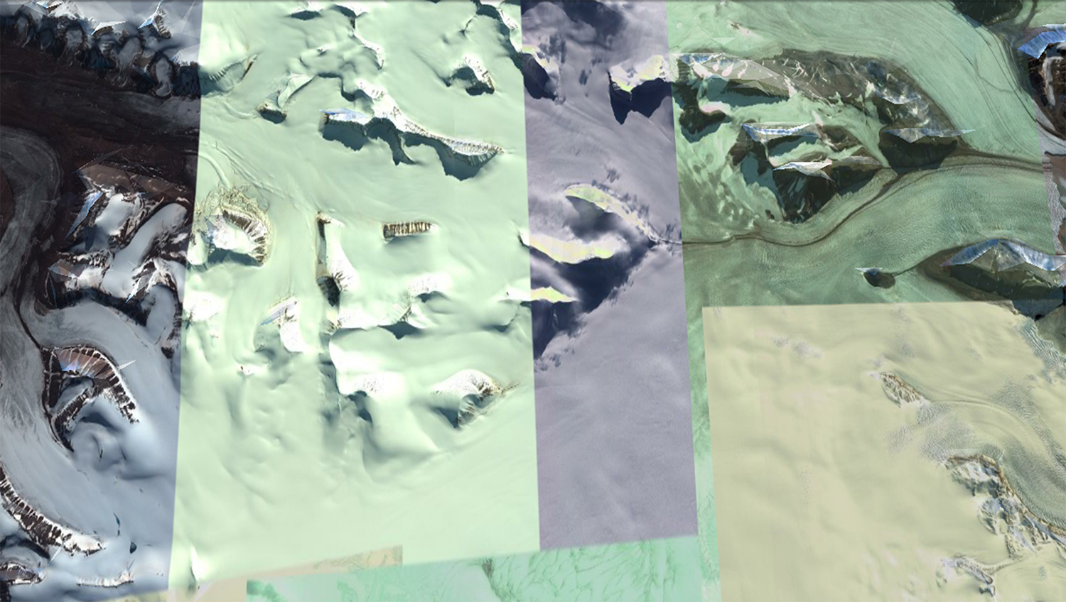
Satellite Earth observation and space based instruments create the potential for predictive vision on a global scale. These identify atmospheric chemicals, tracking shifting topographies, crude spills, algal blooms, pathogens and border surveillance. Two satellite programmes capture imagery and data sets for the purpose of low orbit observation: the Landsat and Copernicus satellite fleets. Using an array of monitoring devices, multiple images captured at different times are stitched together to give a view of the Earth in meticulous detail. The satellites follow a constant trajectory, tracing sun-synchronous orbits and cloud prediction to prevent shadows cast across the terrain, in order to provide an uninterrupted stream of information for forecasting.
The European-directed Copernicus fleet consists of five satellites collectively referred to as Sentinels. A vocabulary of passivity and neutral knowledge production is applied to these satellite missions. Clean, absolute and all seeing, these space-based bodies are tools in the ultimate aspiration of conquering time and distance. Landsat 7 passes over the equator each day at 10am local time. Taking ninety-nine minutes to complete a single orbit, the satellite makes over fourteen orbits a day; a quarter of the Earth’s surface is scanned and archived in just sixteen days. Such regularity means it is be possible to calculate when one of these satellites is passing overhead, moving at speeds and distances well beyond human scale.
The combined monitoring technology of the Sentinels and Landsat 7 is considered to have the same level of accuracy as ground level observation. They offer up an expansive - though imprecise and fragmented - map of the Earth. This digital view generates a two-dimensional compression of reality. Devoid
of a horizon, it offers only an illusion of perspective, skewed by data that is knitted together to reveal evidence of the past and to provide data for strategic projections of political, economic, social and environmental futures. In 2003, a hardware component failure left wedge-shaped tranches of missing data on either side of Landsat 7’s images. The perfect, or total image is not present in the abstracted and fragmented visualisations generated. Portions of terrain are misaligned, obscured by blind spots or cloud cover. Instead of the desired, pure image produced in real time - a claim to total vision and predictive potential - the satellite lens operates more like a scrying mirror.
An attempt to see more clearly or completely is affected by the material nature of the technology – a surface, which reflects back in the present, making visible misalignments and fissures.
![]()
The Svalbard Satellite Station sits in the Norwegian archipelago of Svalbard in the Arctic Ocean. Operated by Kongsberg Satellite Services, it is the world’s largest commercial satellite ground station.
Research facilities from many nations are collocated on Svalbard as a strategic point
for Earth monitoring. Low altitude satellites collect information as they orbit the Earth. The captured data is downloaded directly to
a ground station once it is within the line of sight.
For most of the 19th century, Norwegian hunters and itinerant whalers dominated economic exploitation on Svalbard.
The coal mining industry on Svalbard developed during the early 20th century,
but according to archaeologists the use of the coal seams can be traced further back. Russian and European scientists and prospectors turned their eyes to the archipelago, with natural resources representing both a source of knowledge
and a potential economic asset.
![]()
According to estimates made by the US Geological Survey, about thirteen percent
of undiscovered oil, thirty percent of undiscovered natural gas, and twenty percent of undiscovered natural gas liquids remain beneath the Arctic ice.
Under the United Nations Convention on the Law of the Sea, a country can legally extend its rights over oil and gas deposits to the edge of its continental shelf, even if this stretches beyond the 200-mile exclusive economic zone. For states that border this region, it is necessary to develop infrastructure in order to exploit this concealed resource. Russia has made this one of its highest national priorities and has consequently built up the world’s largest fleet of icebreakers and invested more in Arctic infrastructure than any other country. Russia is also building deep-water ports and rail terminals to service the Northern Sea Route, while the USA and Canada have made proposals for similar kinds of infrastructure for the Northwest Passage.
![]()
Due to the terrain and the extreme conditions of the Arctic region, in the past drilling setbacks and uncertain regulations on environmental policy have led to the withdrawal of three major oil companies
from Alaska: ConocoPhillips, Royal Dutch Shell, and Statoil.
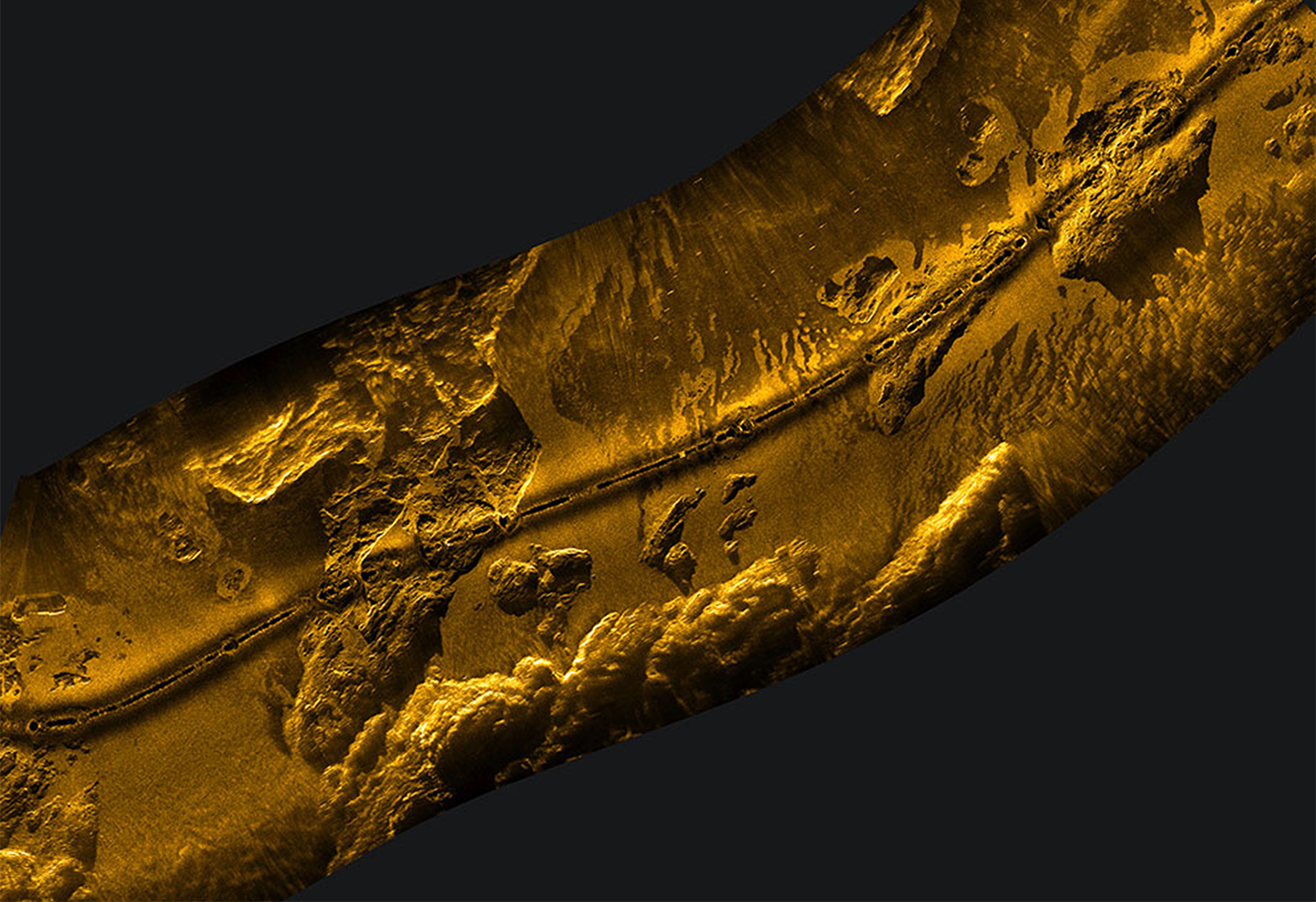
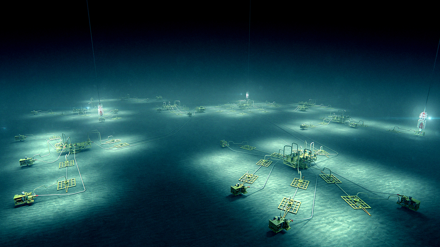
Predictive vision afforded by satellite monitoring can highlight changes in sea ice cover to aid increased mobility and navigation in previously ice locked passages and increasingly provide an overview of
sub-sea terrains. Sonar and bathymetric mapping are used to monitor oil and natural gas extraction infrastructures on the seabed, reducing the material and financial risk of large-scale oceanic platforms.
![]()
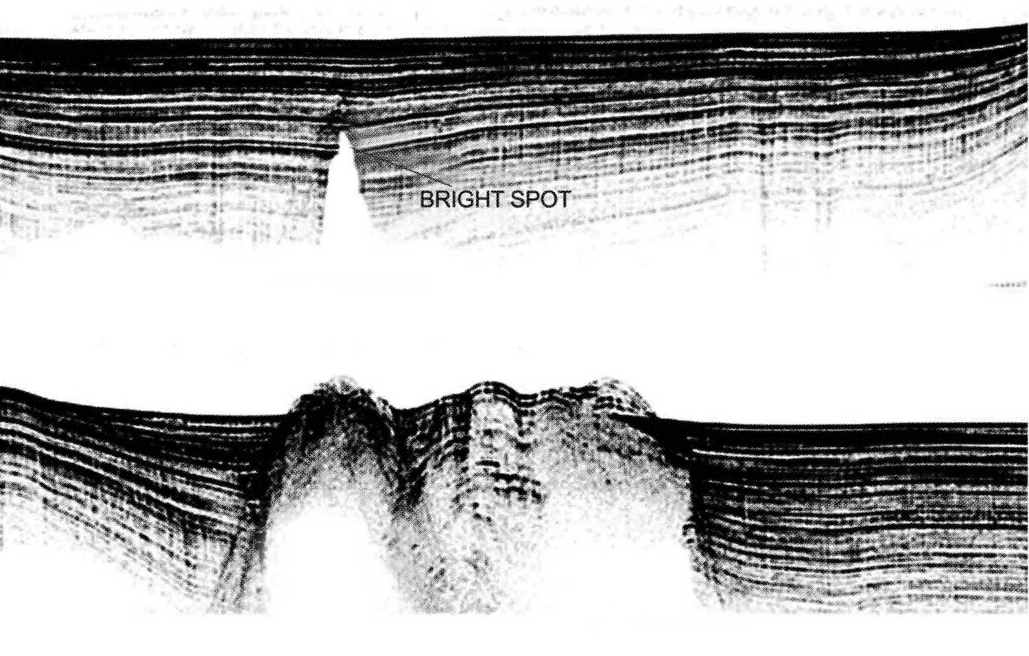
Prospectors speculate on the location of mineral seams and oil deposits. Hydrocarbons migrate upwards from their source, passing through porous subterranean strata, before accumulating when a layer of impermeable rock blocks their route. Geologists use seismic data to detect bright spots - sonar reflections with anomalously high amplitudes, which suggest the presence of hydrocarbons beneath a lithic trap.
![]()
The Siberian tundra is an open, sub-Arctic landscape with little tree growth that is home to the largest peat bogs on the planet. The ground is spongy, and chiefly composed of moss and decomposing vegetation, or histosol. Peat bogs are the initial stage in the lengthy process of plant material forming as coal; ancient bog plants can be found as fossils in peat. The peat bogs and thermokast lakes of the Siberian peninsular are polygonal bogs, shaped with ridges. Thermokast lakes are defined as lakes that generally occupy closed basins formed by the settlement of ground, following the thawing of ice-rich permafrost.
In various parts of Siberia, the active layer above the permafrost can thaw to a depth
of fifty centimetres every summer. In 2016 however, there was a heat wave in the region and temperatures remained around thirty-five degrees Celsius, twenty-five degrees warmer than that of an average summer. According to scientific studies, in 2005 the frozen bogs in Siberia began to thaw for the first time in 11,000 years and as a result the number of lakes has increased but the average surface area of lakes has decreased as water evaporates or escapes where the underlying permafrost has melted.
The indexical nature of permafrost soil is skewed by freeze-thaw cycles.
Frost churning causes materials to mix from various soil strata’s. The result is a marbling of matter from significantly different time periods.
![]()
While many strains of bacteria including anthrax occur naturally in soil, extensive thawing of permafrost increases the risk of exposure to spore-producing bacteria like Bacillus Anthracis , which can survive dormant in freezing temperatures for up to a century.
In 2016, more than 2,300 reindeer died in the anthrax outbreak in the Yamalo-Nenets region of Siberia; Nenets herders were affected most significantly.
However, increased resource extraction, land evictions and diminishing grazing pastures represent an ongoing and increasing threat.
The Yamal Megaproject (a long term project designed to exploit the peninsula’s gas, developed by the Russian corporation Gazprom) was initiated in the 1990s.
In May 2012, the first of its gas supplies came from the Bovanenkovo Field. Every year, billions of cubic metres of gas are piped to Western Europe.
As the sea ice around the peninsula melts and the ocean opens to maritime traffic, Arctic sea routes act as potential gateways for trade and exploitation of gas reserves.
Earth vision technology from satellites can serve to detect and document topographical and geologic changes on a global scale. However simultaneously accounts of diminishing mosquito populations, localised bacterial outbreaks and flora variation suggest an intimate knowledge on the basis of daily-lived experiences at ground level.
![]()
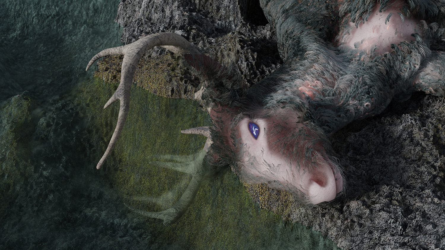
Vision may be impeded and skewed under climatic and social conditions. The eyes of reindeer change colour, from gold in summer months to blue in long months of Arctic winter darkness. It is thought that in prolonged darkness, the pressure inside the animal's eye builds as a result of the effort required to keep the pupils dilated for months on end.
The pressure causes the collagen fibres of the iridescent tapetum lucidum to contract, reflecting blue wavelengths of light instead
of yellow. The blue eyes become over a thousand times more sensitive to light to cope with significantly reduced visibility.
![]()
As azolla plants grow, colonising the majority of the surface of a pool or lake, they reduce the oxygen levels beneath the water to the detriment and eventual mass mortality of other aquatic organisms. The miniscule fern grows much faster than other flora that is found in waterlogged ground or peaty bogs, and can be used as livestock feed. The symbiotic relationship between the Azolla and nitrate-producing bacteria makes it a suitable fertilizer for agricultural production. Azolla, like other semi-aquatic wetland plant species can sequester enormous amounts of carbon over many years, absorbing it into their own biomass.
The protection of undeveloped peat land and the reintroduction of wetlands across Europe is an attempt to offset the deferred effects of carbon released during the last five hundred years. The last significant Earth cooling thought to be caused by plant blooms, occurred over a fifty thousand years period.
![]()
The European-directed Copernicus fleet consists of five satellites collectively referred to as Sentinels. A vocabulary of passivity and neutral knowledge production is applied to these satellite missions. Clean, absolute and all seeing, these space-based bodies are tools in the ultimate aspiration of conquering time and distance. Landsat 7 passes over the equator each day at 10am local time. Taking ninety-nine minutes to complete a single orbit, the satellite makes over fourteen orbits a day; a quarter of the Earth’s surface is scanned and archived in just sixteen days. Such regularity means it is be possible to calculate when one of these satellites is passing overhead, moving at speeds and distances well beyond human scale.
The combined monitoring technology of the Sentinels and Landsat 7 is considered to have the same level of accuracy as ground level observation. They offer up an expansive - though imprecise and fragmented - map of the Earth. This digital view generates a two-dimensional compression of reality. Devoid
of a horizon, it offers only an illusion of perspective, skewed by data that is knitted together to reveal evidence of the past and to provide data for strategic projections of political, economic, social and environmental futures. In 2003, a hardware component failure left wedge-shaped tranches of missing data on either side of Landsat 7’s images. The perfect, or total image is not present in the abstracted and fragmented visualisations generated. Portions of terrain are misaligned, obscured by blind spots or cloud cover. Instead of the desired, pure image produced in real time - a claim to total vision and predictive potential - the satellite lens operates more like a scrying mirror.
An attempt to see more clearly or completely is affected by the material nature of the technology – a surface, which reflects back in the present, making visible misalignments and fissures.
The Svalbard Satellite Station sits in the Norwegian archipelago of Svalbard in the Arctic Ocean. Operated by Kongsberg Satellite Services, it is the world’s largest commercial satellite ground station.
Research facilities from many nations are collocated on Svalbard as a strategic point
for Earth monitoring. Low altitude satellites collect information as they orbit the Earth. The captured data is downloaded directly to
a ground station once it is within the line of sight.
For most of the 19th century, Norwegian hunters and itinerant whalers dominated economic exploitation on Svalbard.
The coal mining industry on Svalbard developed during the early 20th century,
but according to archaeologists the use of the coal seams can be traced further back. Russian and European scientists and prospectors turned their eyes to the archipelago, with natural resources representing both a source of knowledge
and a potential economic asset.

According to estimates made by the US Geological Survey, about thirteen percent
of undiscovered oil, thirty percent of undiscovered natural gas, and twenty percent of undiscovered natural gas liquids remain beneath the Arctic ice.
Under the United Nations Convention on the Law of the Sea, a country can legally extend its rights over oil and gas deposits to the edge of its continental shelf, even if this stretches beyond the 200-mile exclusive economic zone. For states that border this region, it is necessary to develop infrastructure in order to exploit this concealed resource. Russia has made this one of its highest national priorities and has consequently built up the world’s largest fleet of icebreakers and invested more in Arctic infrastructure than any other country. Russia is also building deep-water ports and rail terminals to service the Northern Sea Route, while the USA and Canada have made proposals for similar kinds of infrastructure for the Northwest Passage.
Due to the terrain and the extreme conditions of the Arctic region, in the past drilling setbacks and uncertain regulations on environmental policy have led to the withdrawal of three major oil companies
from Alaska: ConocoPhillips, Royal Dutch Shell, and Statoil.
Predictive vision afforded by satellite monitoring can highlight changes in sea ice cover to aid increased mobility and navigation in previously ice locked passages and increasingly provide an overview of
sub-sea terrains. Sonar and bathymetric mapping are used to monitor oil and natural gas extraction infrastructures on the seabed, reducing the material and financial risk of large-scale oceanic platforms.
Prospectors speculate on the location of mineral seams and oil deposits. Hydrocarbons migrate upwards from their source, passing through porous subterranean strata, before accumulating when a layer of impermeable rock blocks their route. Geologists use seismic data to detect bright spots - sonar reflections with anomalously high amplitudes, which suggest the presence of hydrocarbons beneath a lithic trap.
The Siberian tundra is an open, sub-Arctic landscape with little tree growth that is home to the largest peat bogs on the planet. The ground is spongy, and chiefly composed of moss and decomposing vegetation, or histosol. Peat bogs are the initial stage in the lengthy process of plant material forming as coal; ancient bog plants can be found as fossils in peat. The peat bogs and thermokast lakes of the Siberian peninsular are polygonal bogs, shaped with ridges. Thermokast lakes are defined as lakes that generally occupy closed basins formed by the settlement of ground, following the thawing of ice-rich permafrost.
In various parts of Siberia, the active layer above the permafrost can thaw to a depth
of fifty centimetres every summer. In 2016 however, there was a heat wave in the region and temperatures remained around thirty-five degrees Celsius, twenty-five degrees warmer than that of an average summer. According to scientific studies, in 2005 the frozen bogs in Siberia began to thaw for the first time in 11,000 years and as a result the number of lakes has increased but the average surface area of lakes has decreased as water evaporates or escapes where the underlying permafrost has melted.
The indexical nature of permafrost soil is skewed by freeze-thaw cycles.
Frost churning causes materials to mix from various soil strata’s. The result is a marbling of matter from significantly different time periods.
While many strains of bacteria including anthrax occur naturally in soil, extensive thawing of permafrost increases the risk of exposure to spore-producing bacteria like Bacillus Anthracis , which can survive dormant in freezing temperatures for up to a century.
In 2016, more than 2,300 reindeer died in the anthrax outbreak in the Yamalo-Nenets region of Siberia; Nenets herders were affected most significantly.
However, increased resource extraction, land evictions and diminishing grazing pastures represent an ongoing and increasing threat.
The Yamal Megaproject (a long term project designed to exploit the peninsula’s gas, developed by the Russian corporation Gazprom) was initiated in the 1990s.
In May 2012, the first of its gas supplies came from the Bovanenkovo Field. Every year, billions of cubic metres of gas are piped to Western Europe.
As the sea ice around the peninsula melts and the ocean opens to maritime traffic, Arctic sea routes act as potential gateways for trade and exploitation of gas reserves.
Earth vision technology from satellites can serve to detect and document topographical and geologic changes on a global scale. However simultaneously accounts of diminishing mosquito populations, localised bacterial outbreaks and flora variation suggest an intimate knowledge on the basis of daily-lived experiences at ground level.
Vision may be impeded and skewed under climatic and social conditions. The eyes of reindeer change colour, from gold in summer months to blue in long months of Arctic winter darkness. It is thought that in prolonged darkness, the pressure inside the animal's eye builds as a result of the effort required to keep the pupils dilated for months on end.
The pressure causes the collagen fibres of the iridescent tapetum lucidum to contract, reflecting blue wavelengths of light instead
of yellow. The blue eyes become over a thousand times more sensitive to light to cope with significantly reduced visibility.
As azolla plants grow, colonising the majority of the surface of a pool or lake, they reduce the oxygen levels beneath the water to the detriment and eventual mass mortality of other aquatic organisms. The miniscule fern grows much faster than other flora that is found in waterlogged ground or peaty bogs, and can be used as livestock feed. The symbiotic relationship between the Azolla and nitrate-producing bacteria makes it a suitable fertilizer for agricultural production. Azolla, like other semi-aquatic wetland plant species can sequester enormous amounts of carbon over many years, absorbing it into their own biomass.
The protection of undeveloped peat land and the reintroduction of wetlands across Europe is an attempt to offset the deferred effects of carbon released during the last five hundred years. The last significant Earth cooling thought to be caused by plant blooms, occurred over a fifty thousand years period.
1) Image : Google Earth which utilises both Landsat 7
and Sentinel-2 data
2) Image : Proba-1 images Svalbard ground station,
Released 21/04/2016 10:29 am, ESA
3) image : Klein Marine Systems inc. side scan sonar
image of subsea pipelines
4) Environment and Society journal 'The Northwest Passage: Myth, Environment, and Resources’
5) Image : Aker Solutions: Subsea Factory
Floor monitoring technology
6) In their 2011 paper published in Global Health Action, Boris A. Revich and Marina A. Podolnaya wrote, “As a consequence of permafrost melting, the vectors of deadly infections of the 18th and 19th centuries may come back, especially near the cemeteries where the victims of these infections were buried.”
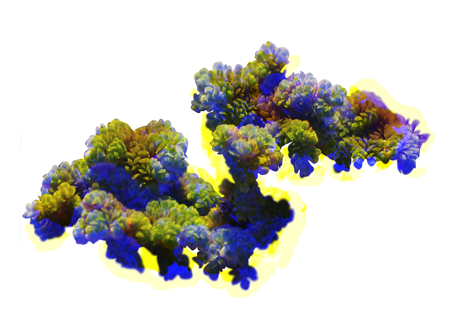
7)CG Imagery created by Jake Moore.